
Informationen zum Flugplatz Sauldorf-Boll
Wetter
Allgemeine Informationen
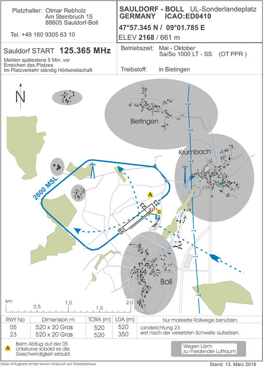
Flugplatzname: Sauldorf - Boll
Zugelassen für: D-Mxxx bzw. Ultraleicht, UL-Heli, Trike, Motor(gleit)schirm, Tragschrauber (Gyrocopter)
Koordinaten: N 47° 57' 20'' E 09° 01' 47''
Platzlänge: 520m (Landung auf 23: 350m)
Platzhöhe: 661m / 2168ft MSL
Frequenz: 125.365 MHz
Rufname: Sauldorf Start
Funkbesetzung: (von April bis Oktober)
mittwochs 15 - SS UTC
Samstag, Sonntag, Feiertag: 08 - SS UTC
PPR:
Otmar Rebholz: +49 160 930 563 10
Email: info@ulboll.de
Anflugkarte
KML Datei - Platzrunde Sauldorf-Boll
KML Datei zum Import in die Moving-Map-Software
